Navigating the Deep: Precision Methodology in Maritime Archaeology
OAR’s underwater division provides technical assistance and and sub-surface analysis by blending advanced technology, field operations, and historical archive research to execute rigorous maritime studies, high-precision anomaly investigations, and targeted ground-truthing. Our services focus on utilizing remote sensing for data collection and deploying specialized divers to physically verify submerged cultural resources while maintaining environmental integrity.
Sub-Surface Technical Excellence
Conducting rigorous maritime study requires a blend of advanced technology, physical endurance, and operational discipline. Underwater environments introduce challenging variables, ranging from shifting thermoclines and unpredictable currents to zero-visibility conditions, that demand specialized remote sensing capabilities and highly trained personnel. To address these complexities, our maritime operations serve as high-precision assistance engineered specifically for documentation, anomaly investigation, and comprehensive site assessments.
Advanced Target Ground-Truthing
Effective maritime resource management lies in the transition from digital data collection to physical verification. High-resolution side-scan sonar and marine magnetometry are indispensable tools for broad-spectrum landscape scanning, yet the resulting data anomalies require meticulous, hands-on validation. Our field teams specialize in targeted ground-truthing operations, deploying specialized divers to investigate, document, and identify submerged cultural resources. Every dive investigation is executed with a focus on maximizing data collection of the site while preserving total integrity of the surrounding marine ecosystem.
The Intersection of Safety and Science
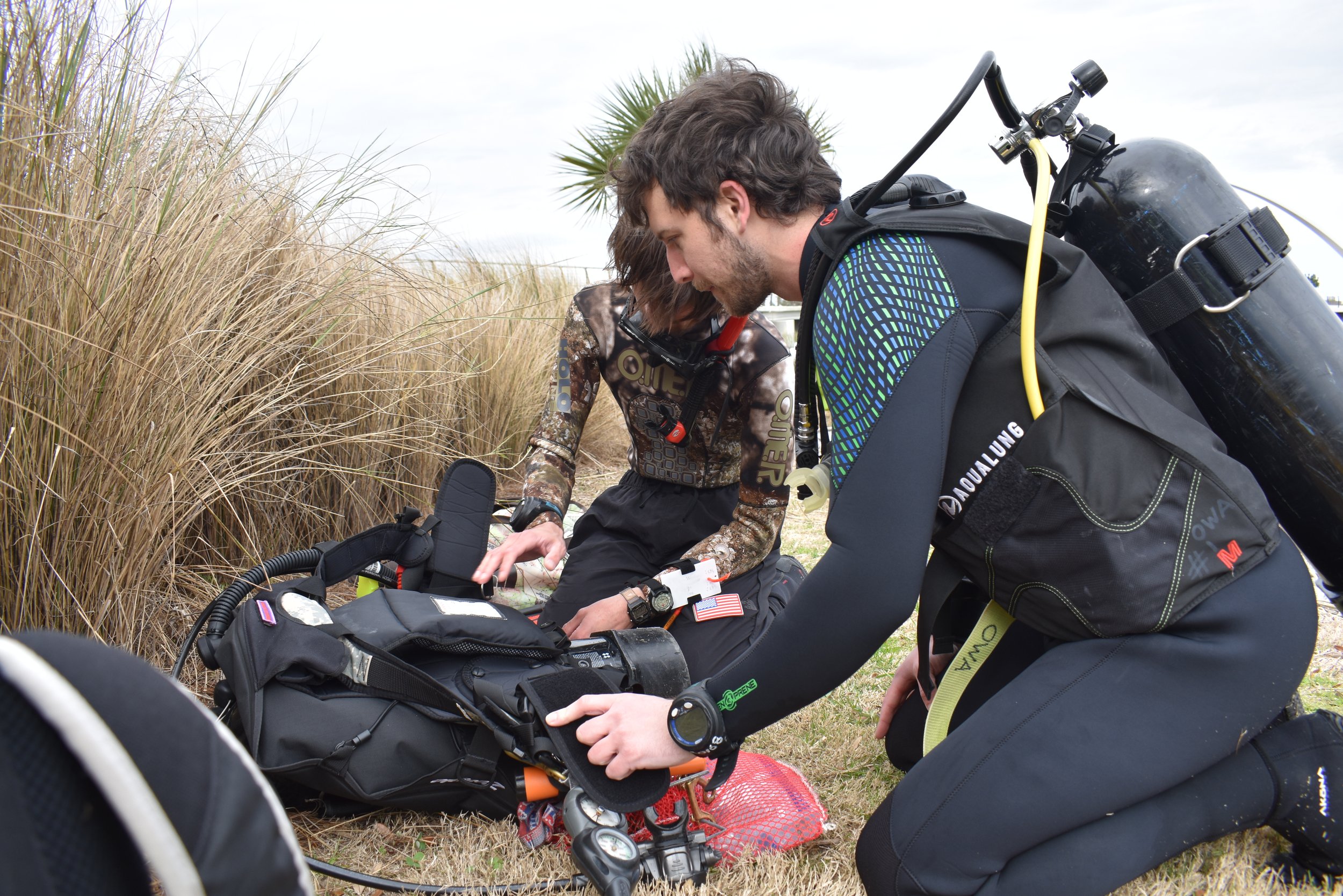
Operating safely in marine environments is the framework that makes the science possible. Rooted in a deep foundational understanding of wilderness medicine and operational safety protocols, our diving support teams manage sub-surface risks through rigorous pre-dive planning, redundant equipment configurations, and strict adherence to safety standards.
Collaborative Field Deployments
The challenges of modern cultural resource management and academic research require flexible, highly adaptable field capabilities. Our maritime operations are structured to seamlessly integrate into existing project workflows, providing specialized remote sensing support, hydrographic mapping, and diving assets to institutions and project directors. Whether defining the boundaries of a historic shipwreck site, validating an isolated acoustic anomaly, or conducting a pre-construction environmental survey, our underwater team delivers the precise datasets and field execution necessary to bring the hidden history of our waterways to light.
Contact Us
News to share? news@originarchaeology.org
Laboratory Department
